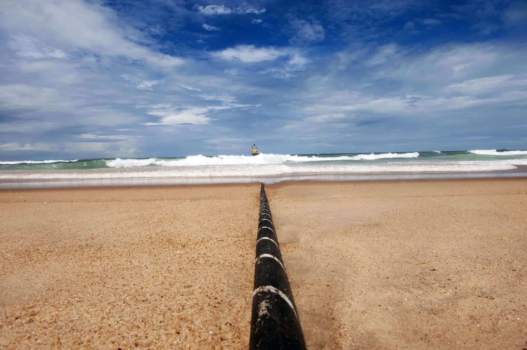
Canalink, a public company under the Canary Islands Government’s Tenerife Cabildo via the Technological Institute of Renewable Energies (ITER), has taken a significant step in protecting the marine environment by joining ATLAS (Atlantic Tracking with Lightwave Acoustic Sensing). This European project transforms existing underwater fiber optic cables on the Atlantic seabed into a network of acoustic sensors. It leverages DAS (Distributed Acoustic Sensing) technology to detect cetaceans, map submarine noise, and issue early earthquake alerts at sea, paving the way for a new generation of multipurpose ocean observatories based on current telecommunication infrastructure.
Funded under the Interreg Atlantic Area program, the project is
What ATLAS Aims for: Real-Time Science, Maritime Safety, and Biodiversity
ATLAS has a dual purpose. On one hand, to develop advanced data acquisition, calibration, and validation systems that turn fiber optic cables into multipurpose observation platforms. On the other, to deliver that information to those who need it—authorities, scientists, maritime operators, and the public—through a digital platform sharing standardized data formats compatible with European frameworks such as the Mediterranean Strategy Framework Directive (MSFD), EMODnet, and Copernicus.
Practically, DAS technology enables “to listen” to the marine environment along dozens or hundreds of kilometers of cable. This capability translates into high-impact public applications like:
- Cetacean Conservation: issuing warnings to navigators in zones with sensitive species—such as the
- Submarine Noise Management: creating targeted maps to help mitigate acoustic impact from navigation and other activities.
- Early Seismic Alerts: providing early signals of sea earthquakes that strengthen the resilience of coastal communities and navigation safety.
For the Northeastern Atlantic, where major traffic routes and biological corridors converge, these measures are especially relevant. For the Canary Islands, a hub of commercial routes and a hotspot of biodiversity, the potential is clear: more integrated data, faster and better, informing decision-making systems.
How It Works: From Fiber Optics to Ocean “Ears”
ATLAS is not starting from scratch. Its value lies in leveraging existing submarine telecommunication cables as supports for distributed acoustic sensing. DAS technology enables a single cable to function as thousands of virtual microphones along its length, allowing the detection of vibrations associated with both fauna presence and physical phenomena (waves, currents, seismic activity) or human activities (ship traffic, machinery).
The project focuses on three key technical fronts:
- Acquisition: designing and deploying robust data collection systems on operational communication cables.
- Calibration: ensuring that the recorded signals accurately correspond to real events, minimizing false positives/negatives.
- Validation: cross-checking DAS records with independent observations (hydrophones, buoys, seismic recordings, sightings) to guarantee data quality before operational deployment.
The expected result is a real-time data flow that feeds models and dashboards useful for environmental managers, port authorities, research centers, and emergency services.
A Data Standard for Europe: From ATLAS to MSFD, EMODnet, and Copernicus
Equally important as listening to the ocean is sharing what is heard. ATLAS will develop a digital platform that publishes data in interoperable formats, aligned with the needs of authorities responsible for the MSFD, and compatible with EMODnet and Copernicus. This approach avoids information silos and ensures that the same data can serve multiple purposes: conservation, safety, research, maritime planning, and regulatory compliance.
For Canalink and ITER, aligning with European standards adds strategic value: observations in the Canary Islands will enter open science circuits and continental operational services, amplifying impact beyond insular boundaries.
Who’s Behind This: An Atlantic Consortium with Spanish Leadership
ATLAS is an Interreg Atlantic Area research project led by PLOCAN (Spain), with a budget of 3.4 million euros, 75% co-financed by ERDF. Alongside Canalink (Spain), participating entities include, among others, University College Cork (MaREI, Ireland) and INESC TEC (Portugal). The consortium also comprises GREENOV-ITES, MOOD Conseil (France), CEREMA, SHOM (France’s Hydrographic and Oceanographic Service), and two associated entities: NTNU (Norwegian University of Science and Technology) and EMSO ERIC’s CMO office.
The collaboration among cable operators, scientific centers, and public agencies is vital for field testing the technology and accelerating its deployment in operational cases.
Why Canary Islands: A Living Laboratory between Biodiversity and Major Routes
The Canary Islands archipelago embodies several factors making ATLAS a natural fit:
- Atlantic Crossroads: high ship traffic and global connectivity, with submarine cables linking Europe, Africa, and the Americas.
- Rich Cetacean Diversity: presence of resident and migrating species, with a recognized sensitivity to collisions and noise pollution.
- Ocean Seismic Risk: need for improved alerts and response protocols for sea seismic events.
The public participation of Canalink—dependent on the Tenerife Cabildo through ITER—offers additional institutional legitimacy and alignment with regional policies in energy, R&D, and environmental protection.
Challenges and Next Steps: Technological Maturity, Governance, and Operational Use
While the proof of concept for DAS on fiber optic cables looks promising, ATLAS faces several natural challenges typical to deploying new technology:
- Fine calibration in complex environments: distinguishing acoustic patterns of fauna, traffic, and physical phenomena without ambiguities.
- Data governance: ensuring quality, ownership, privacy, and clear licensing in the data capture–processing–publication pipeline.
- Operational integration: translating signals into decisions—for example, dynamic warnings to navigators—with procedures, thresholds, and responsible parties pre-established.
- Sustainability and maintenance: ensuring the system can operate over time with realistic costs and resources, without interfering with the cables’ primary mission (telecommunications).
The timeline extending to early 2028 allows for iterating prototypes, validating algorithms, and piloting services with maritime authorities, national parks, and monitoring centers. The ideal outcome at project completion is establishing a functional operational capacity that Europe can replicate across other Atlantic cables.
Social Benefits: Shared Knowledge and Informed Decisions
The promise of ATLAS isn’t just generating graphics for conferences but providing useful services:
- Safer, Responsible Navigation: real-time warnings to mariners in areas with high cetacean presence.
- Evidence-Based Management: maps of underwater noise and indicators to inform public policies and mitigation plans.
- Event Resilience: early signals of sea earthquakes that improve reaction times and inter-agency coordination.
- Open Science: standardized data for research, modeling, and education, integrated into EMODnet and Copernicus.
Amidst the growing importance of a blue economy and ecological transition, high-quality data for balancing conservation and development makes leveraging existing submarine infrastructure as a sensing network both ingenious and prudent.
Conclusion: Listening to the Atlantic to Better Protect It
ATLAS introduces a new perspective on infrastructures society considers a given: submarine cables. What was once merely about connectivity can now also serve as environmental observation, early warning, and improved ocean governance. With Canalink, ITER, and a top-tier Atlantic consortium, Canary Islands and Spain position themselves at the forefront of a European trend: transforming the communication network into a protective network.
Frequently Asked Questions
What is DAS technology applied to submarine cables, and what is its purpose?
DAS (Distributed Acoustic Sensing) allows a fiber optic cable to be used as a continuous sensor line along its length. In ATLAS, it’s employed to detect cetaceans, map submarine noise, and issue early signals for sea earthquakes. Its goals are improved conservation, maritime safety, and resilience.
What tangible benefits does this bring to the public and maritime sectors?
The ATLAS data can become warnings to navigators near cetacean zones, provide evidence for mitigating underwater noise, and deliver early alerts for seismic events. These enhance safety and biodiversity protection in busy routes.
How will the data be shared, and what standards will be used?
The project will develop a digital platform sharing data in standardized formats, aligned with the MSFD and compatible with EMODnet and Copernicus. This facilitates reuse by authorities, scientists, and maritime operators.
Who are the consortium members, and what’s the project timeline?
Led by PLOCAN (Spain), the ATLAS consortium includes Canalink (Spain), MaREI–University College Cork (Ireland), INESC TEC (Portugal), and others. The project runs until early 2028 with a budget of 3.4 million euros, mainly financed by ERDF.
Ref: canalink.tel